
The Bluff Trail Woodens River Watershed Environmental Organization

Trail open. Provincial burn restrictions apply through wildfire season. No open fires anywhere on the trail.

Read the rules
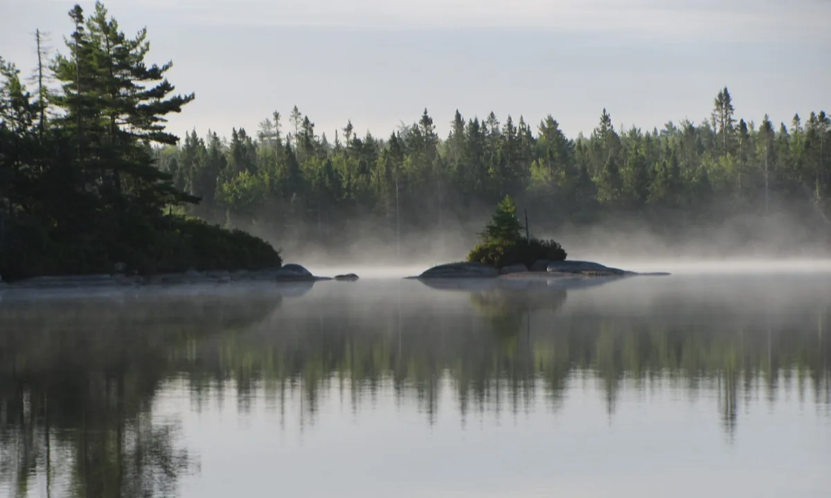
Morning mist rising off Frederick Lake, with a small rocky island and a dense spruce shoreline behind it.

Five Bridge Lakes Wilderness Area · Mi'kma'ki · Nova Scotia

The Bluff Wilderness
Hiking Trail

Thirty-two kilometres of backcountry footpath, minutes from the edge of Halifax. Cut by volunteers between 1997 and 2005, and still maintained by them.

Full system
32 km
Nested loops
4
Loops 1 & 2
7 hrs
Trail completed
2005
Recognition
One of Canada's 8 best urban escapes, Explore magazine

Where it goes

A granite ridge
between two rivers

The route leaves the Beechville-Lakeside-Timberlea rail trail, crosses into the Woodens River watershed, and climbs onto the high ground that gives the trail its name: an open granite bluff dividing the Woodens River watershed from the Nine Mile River watershed to the east.

Above the treeline of the bluff you walk on bare rock and lichen barrens, past glacial erratics left by ice that melted ten thousand years ago. Below it the footpath threads through black spruce, hemlock, red maple, bog laurel, and long stretches of sphagnum where volunteers have laid boardwalk over the wet ground. Nineteen connected lakes run through the watershed across roughly sixty-five square kilometres, and several of them come into view from the ridge on a clear morning.

Frederick Lake, Pot Lake, Upper and Lower Marsh Lake, Hubley Big Lake, and the Five Bridge Lakes chain all sit within the wilderness area. Canoe access points marked on the official map let paddlers reach parts of the trail from the water, which is how a good number of the camping and maintenance trips have started.

The full trail guide

One of the 8 best urban escapes in Canada.

Explore: Canada's Outdoor Magazine, May 2008
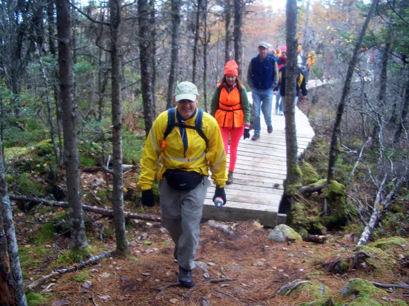
A hiker in a red pack crossing a low wooden boardwalk laid over wet ground between mossy boulders.
Boardwalk over the wet ground on the Mi'kmaw Hill Loop. Every plank was carried in on someone's shoulder.

The four loops

Pick the one that fits your daylight

The loops nest inside one another, so you can turn back at each junction and still walk a complete circuit. Distances below are WRWEO's published figures: from the trailhead, around the outside of each successive loop, and back. They are cumulative, not the length of each loop on its own.

  1. 01 Pot Lake Loop 8.7km Round trip

    The shortest circuit and the usual first visit. From the trailhead around Pot Lake and back is 8.7 km by map measurement, 6.7 km by GPS — enough rock and root to show you what the rest of the system is like before you commit a full day to it.

    Half a day · Yellow markers · Returns to the parking lot

  2. 02 Mi'kmaw Hill Loop 17.4km Round trip

    Out over Mi'kmaw Hill and back, taking in the Pot Lake Loop on the way: 17.4 km by map measurement, 14.0 km by GPS. This is the full seven-hour day the trailhead signs describe. Formerly the Indian Hill Loop, renamed in 2016 on the advice of the Mi'kmaw community.

    A full day · Blue markers · Canoe access at Cranberry Lake

  3. 03 The Bluff Loop 23.4km Round trip

    The loop the trail is named for, and the one with the open barrens and the long view. It crosses the Bluff plateau, one of the highest points near Halifax. Reaching it on foot and back is 23.4 km by map, 18.4 km by GPS — a dawn-to-dusk outing, or a day trip if you paddle in to Frederick Lake.

    Dawn to dusk · Red markers · Canoe access at Frederick Lake

  4. 04 Hay Marsh Loop 29.0km Round trip

    The furthest circuit, out around Upper Five Bridge Lake. Least travelled, wettest underfoot, and the section where a compass earns its place in your pack. On foot it is 29.0 km by map, 22.9 km by GPS, and can take six hours just to reach — paddling in via Hubley Big Lake cuts that to under an hour.

    Longest day · Orange markers · Canoe access at Hubley Big Lake

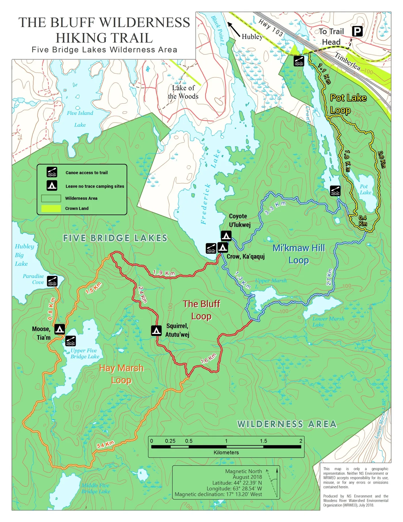
Official topographic map of The Bluff Wilderness Hiking Trail showing the four colour-coded loops, lakes, camping sites, and canoe access points.
Official map produced by Nova Scotia Environment and WRWEO, available at full size. Carry a paper copy, because phones run out of battery in the cold. Distances, GPX and map skills

Stewardship

What a year of volunteering
actually adds up to

The Bluff Trail Stewardship Program logs every hour on the ground: brush cutting, boardwalk work, sign replacement, campsite inspections, and remediating the damage left behind. These are the 2024 figures, the most recent published year.

1,999 Hours of stewardship presence on the trail, 72% of them volunteered
$79,067 Value of the program in 2024, and $625,586 since it began in 2017
84% Of the 2,265 trail users seen were spoken to, the highest rate on record

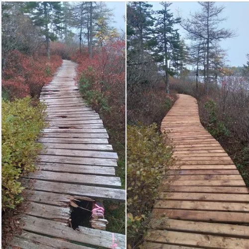
The long boardwalk has been replaced

The boardwalks carry hikers over sphagnum and standing water that would otherwise be trampled into a widening mud channel. Two decades of Nova Scotia winters had worked through the original lumber. Some of the funding needed to do the whole job at once did not materialise, so the work was split across two years — and finished in November 2024.

  • 2023 Phase one, all face boards replaced $26,000
  • 2024 Phase two, stringers and posts replaced $53,000

Funded by the Province of Nova Scotia through the Department of Communities, Culture, Tourism and Heritage, by Halifax Regional Municipality, by Councillor Iona Stoddard, and by donations from trail users and WRWEO members. Materials were hauled in and installed by volunteers.

Volunteer on the trail Report a problem on the trail

Before you go

This is signed for experienced hikers

The signs at the trailhead say so, and they mean it. There are no services on the trail, no reliable cell coverage, and long distances between exits. Plan to be finished in daylight.

Carry all of this

  • Map and compass, and the ability to use both
  • First aid kit
  • Water, plus a filter or purifier
  • More food than the day requires
  • Warm layers and rain gear
  • Knife
  • Matches in a dry container
  • Whistle
  • Flashlight or headlamp
  • A charged phone, understanding that coverage drops out

And leave it the way you found it

Pack out everything you carry in
Including food scraps, orange peel, and toilet paper. Leave-no-trace technique is the standing expectation on this trail.
No open fires
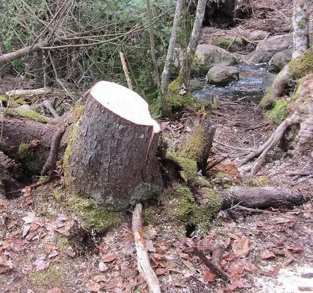
Fire pits are the single largest source of damage volunteers deal with each year. Cook on a stove or eat cold.
Camping is discouraged
WRWEO discourages camping on and around the Bluff Trail. Designated leave-no-trace sites are marked on the map for people committed to the practice.
Stay on the tread
Walking around a wet spot rather than through it is what widens and braids a footpath. The boardwalks exist for this reason.
Tell someone your route
Give a person outside your group your loop, your start time, and when you expect to be back at the car.

The full safety and Leave No Trace guide Dogs Camping

Seasonal advisory

Wildlife. Black bear, moose, and coyote all live in the Five Bridge Lakes Wilderness Area. Make noise on blind corners and give animals room to leave.

Hunting season. Wear hunter orange from late October through early December.

Wildfire season. The Province can close the woods entirely, as it did from August 5 to October 15, 2025. Check provincial fire restrictions the morning you head out.

Support the trail

Every kilometre is maintained by volunteers and paid for by members

Lumber, hardware, signage, fuel, insurance, and several thousand volunteer hours a year go into a footpath that stays free to everyone who shows up at the trailhead. Membership and donations cover the difference.

Membership

$5/ year

Become a member of WRWEO

Five dollars puts your name behind the organization at annual general meetings, in funding applications, and in front of the municipal and provincial bodies that decide what happens to this watershed. Membership numbers carry weight in those rooms. Family and organization memberships, and two- and three-year terms, are also available.

Join through PayPal
Donation

Keep the stewardship program on the trail

The full cost of running the program has not been raised in any year since 2017, so it runs on reduced hours. Donations go into lumber, hardware, signage, fuel, and the coordinator who keeps a trained presence out there.

Donate on CanadaHelps

Time

Come out on a work day

Brush cutting, boardwalk building, campsite inspections, and sign runs happen through the year. Training is provided, and no experience is expected on your first outing.

Volunteer

Watching the watershed

Report what you find out there

Blowdown across the tread, a fire ring, a missing marker, a washed-out section of boardwalk: trail users report all of it, and stewardship volunteers act on the reports. The program logged 130 of them in 2024 alone, and every annual report is built out of them.

Submit a trail report
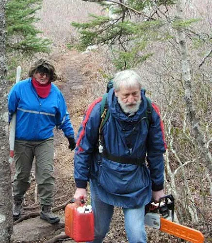
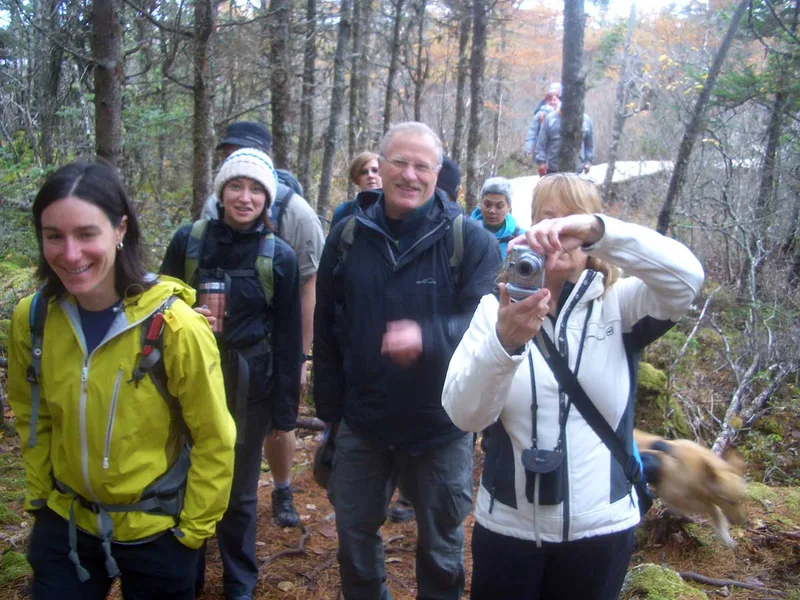
A small group of hikers stopped among bare hardwoods on a November walk, one of them holding a camera.

Thirty years of this

WRWEO, pronounced ree-oh, has been running action projects across the Woodens River watershed since 1995: negotiating with developers and government, sponsoring public events, carrying out field science, restoring damaged ground, and building the trail you walk on. The watershed runs roughly twenty kilometres from the Hubley exit off Highway 103 to St. Margaret's Bay at Woodens Cove, taking in nineteen connected lakes and about sixty-five square kilometres of ground.

Parts of it remain close to pristine wilderness while other parts have been settled for generations, and the work of the organization has always been holding those two realities together in the same watershed.