A meaningful piece of ground
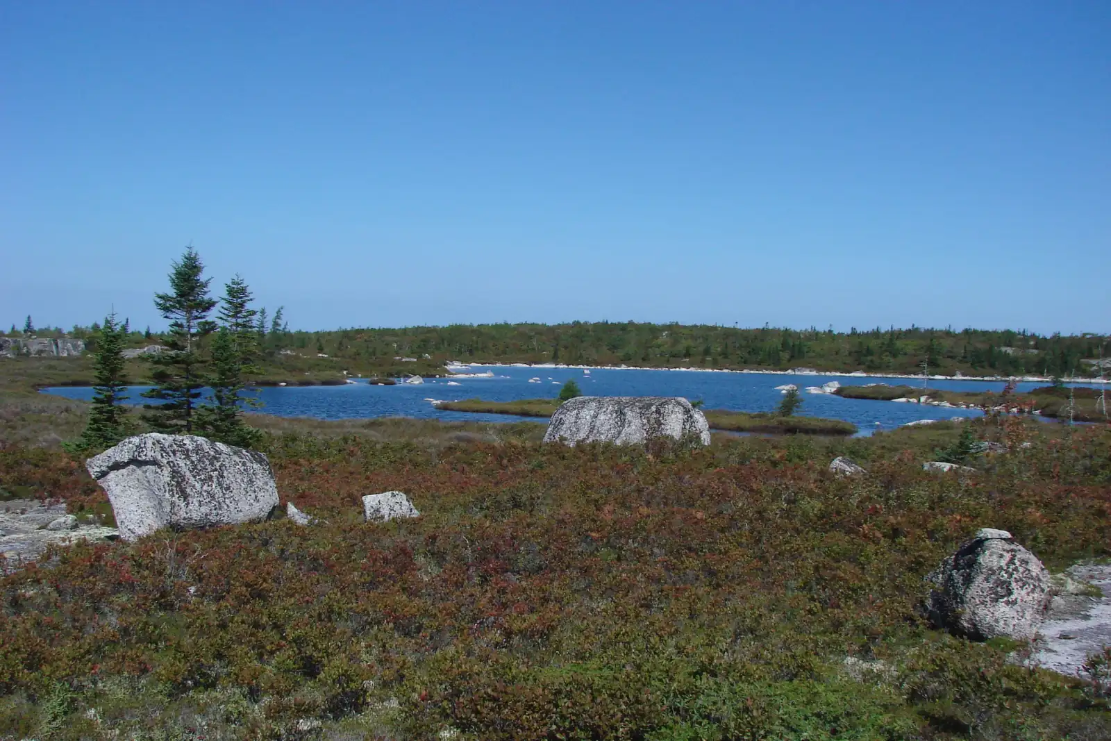
The Woodens River watershed is embedded in a larger landscape, the Chebucto Peninsula. Those lands form a meaningful biogeographical unit by virtue of their common geology and vegetation, their high density of lakes, streams and wetlands, their proximity to the ocean, and their largely rural character. The Five Bridge Lakes Wilderness Area is the largest block of land on the peninsula protected from development.
It is well established in conservation science that larger areas support and conserve more species over time than small ones. Just as important, this area occupies a large space in the centre of the peninsula, which means it would take relatively small steps to construct conservation corridors connecting the different blocks of protected land around it. Corridors would increase the species carrying capacity of every one of those blocks and, collectively, make a very significant conservation area.
Other protected land on the Chebucto Peninsula
- Provincial parks: Long Lake, Crystal Crescent Beach, Lewis Lake, and the Peggy's Cove Preservation Area
- Protected wilderness areas: Terence Bay (designated with 30 other areas in 1998), Blue Mountain–Birch Cove Lakes (2009), and Five Bridge Lakes (2011)
- Nova Scotia Nature Trust: Purcell's Cove Conservation Lands
- Nature reserve: Duncan's Cove
Large blocks of Crown and municipal land remain outside all of these. The HRM lands known as the Western Commons, around Ragged Lake, have been under active consideration for a regional park with a protected wilderness area. Residents on Halifax mainland south continue to seek more protection for the Purcell's Backlands.
How it was protected
Ten years from a public meeting to a designation, carried by a coalition that grew to thirty-five organizations — environmental groups, but also residential associations, recreation groups, businesses and developers.
-
The Five Bridges Wilderness Heritage Trust is formed
Its explicit purpose: conserving the public lands bounded by Highways 103 and 333 in their natural state, for public use. It grew out of an Interim Wilderness Trust WRWEO helped create the same year, after public demand at a large meeting WRWEO sponsored.
-
WRWEO commits to a protection strategy
At its March AGM, WRWEO unanimously resolved to pursue protection under the 1998 Nova Scotia Wilderness Areas Protection Act and to join a coalition pursuing the same end. The Trust passed a similar resolution shortly afterward.
-
The Chebucto Wilderness Coalition forms
WRWEO and the Trust, with the St. Margaret's Bay Stewardship Association, the BLT Rails to Trails Association, the Safety-Minded ATV Association, the Resource Opportunities Centre and others. It grew to more than thirty-five supporting organizations.
-
The case goes to the Minister
Presented on 2 June by the late Dr. Wilfrid Creighton and the coalition. It went on to win the support of HRM Regional Council, the local MP and MLAs, the Liberal and NDP caucuses, and the Department of Natural Resources.
-
Declared a Candidate Wilderness Area
On 19 October, opening two years of public consultation and socio-economic study.
-
Formal designation, after consultation with the Nova Scotia Mi'kmaq
Close to 8,600 hectares, encompassing the entire Bluff Trail, one headwater lake, and parts of several other lakes in the Woodens River watershed.
The area is managed by Nova Scotia Environment and Climate Change, through its Protected Areas and Ecosystems Branch. The Bluff Wilderness Hiking Trail is managed by WRWEO under an agreement with the department; bicycles and motorized vehicles are not permitted on it. The Old Coach Road and Fire Road within the wilderness area are managed by the All-Terrain Vehicle Association of Nova Scotia under a separate agreement.
The FBLWA Stewardship Coalition
On 5 February 2013, representatives of the five groups that led the push for protection agreed to form a community stewardship coalition, to work with Nova Scotia Environment to jointly plan, initiate, prioritize, fund, implement and coordinate projects in the newly protected area. The five groups signed the coalition's charter at a community workshop at the St. Margaret Sailing Club on 16 March 2013.
- Beechville Lakeside Timberlea Rails to Trails Association
- Five Bridge Wilderness Heritage Trust
- Safety-Minded ATV Association
- St. Margaret's Bay Stewardship Association
- Woodens River Watershed Environmental Organization
Founding documents: the coalition charter (PDF) and questions and answers (PDF).
Why it is worth protecting
Brown-water lakes and heritage brook trout
The area encompasses major portions of several watersheds with many magnificent lakes, rivers, streams and wetlands that remain minimally disturbed. Among the species they support are heritage brown-water brook trout populations, and closer to the sea, alewife and American eel. These trout are highly sensitive to habitat degradation and fragmentation, and the brown water that protects them from the effects of acid rain depends on the continued integrity of the land-water system.
A mosaic of terrestrial habitat
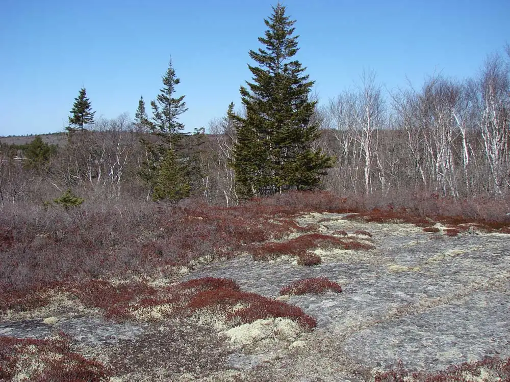
Broadly: extensive, spectacular barrens with pockets of forest and wetland above the Old St. Margaret's Bay Road, and below it largely undisturbed deciduous, mixed and coniferous forest with pockets of barrens, wetlands and treed bogs. That lower forest includes significant old-growth oak and red spruce stands. The old-growth, multi-aged deciduous red oak stand has features that make it unique for Nova Scotia, and the type appears to be rare within eastern North America. The old-growth red spruce stands contain some of the largest red spruce in the province.
Rare and declining species
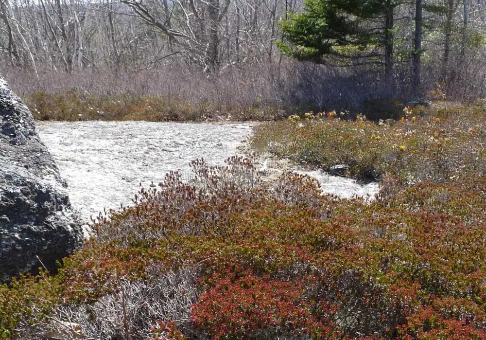
The barrens support healthy populations of broom crowberry (Corema conradii), a coastal plain species threatened outside Nova Scotia — in the Magdalen Islands, PEI and several American states — and declining rapidly within Nova Scotia through habitat loss. The rare mountain sandwort (Minuartia groenlandica) is also found there. Many songbirds that are declining in number breed here, including the Canada warbler. A limited survey of lichens on Bluff Trail loops 1 and 2 revealed more than 100 species.
Endangered mainland moose
The wilderness area is home to a group of roughly 25–30 mainland moose, which are endangered in Nova Scotia. They are indigenous and genetically distinct from the Cape Breton moose, which were established by reintroduction from Alberta in the 1940s. Moose need, or benefit most from, a mix of wetlands, open areas and forest in different successional stages, providing food, cover and relief from heat — and they are negatively affected by roads and trails. This area provides those habitats, largely free of both.
Fish and game for traditional fishing and hunting are likewise protected; such activities are permitted within protected areas.
The case for protecting them beyond the wilderness boundary — and for the corridors that would connect this block of land to the others — is set out at the foot of this page.