
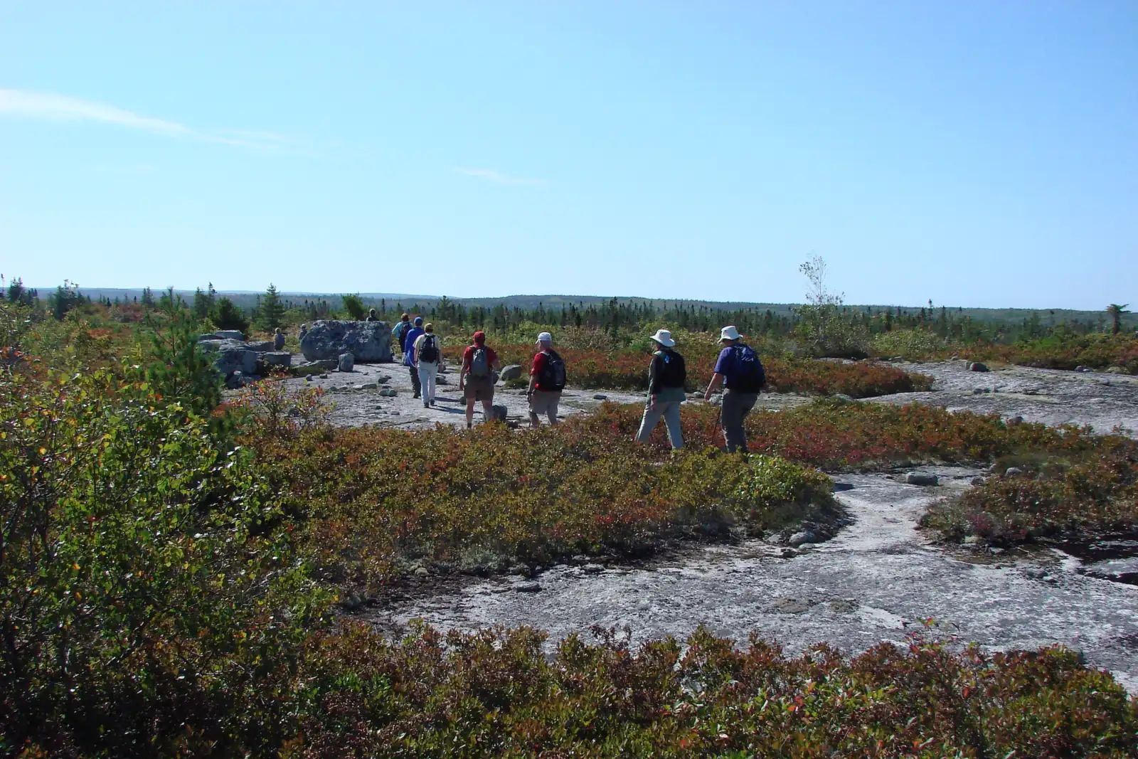
The Bluff Wilderness Hiking Trail lies south of Highway 103 where it crosses the Chebucto Peninsula, just west of K'jipuktuk (Halifax). It begins inside the Woodens River watershed and climbs onto the high ground — The Bluff — that divides that watershed from the Nine Mile River watershed to the east. The whole trail sits inside the Five Bridge Lakes Wilderness Area, designated under the Wilderness Areas Protection Act in October 2011.
The trailhead is on the Beechville-Lakeside-Timberlea (BLT) rail trail, midway between the Highway 103 overpass just south of Exit 4 and the northern tip of Cranberry Lake. A parking lot was built specifically for trail visitors at 2890 St. Margaret's Bay Road.
The four loops
The trail is built as four stacked loops that eventually go around Upper Five Bridge Lake, each nested inside the next and colour-coded on the map and on the trees. Because they nest, you can turn back at each junction and still walk a complete circuit. The first two loops together make a full seven-hour day, and the four-loop system covers more than 30 km.
Each figure below is the round trip from the trailhead, out around the outside of that loop and back — not the length of the loop on its own. Map measurement first; GPS is shorter because it does not account for elevation change.
-
01 Pot Lake Loop 8.7km Round trip
The shortest circuit and the usual first visit: from the trailhead around Pot Lake and back, 8.7 km by map measurement or 6.7 km by GPS. Enough rock and root to show you what the rest of the system is like before you commit a full day to it. It passes a stand of large old-growth red spruce between Pot and Cranberry Lakes.
-
02 Mi'kmaw Hill Loop 17.4km Round trip
Walking the outside of the first two loops and back to the trailhead is 17.4 km by map measurement, 14 km by GPS. This is the seven-hour day the trailhead signs describe, though the signs give the distance as about 12 km. Formerly the Indian Hill Loop; renamed in 2016 on the advice of the Mi'kmaw community.
-
03 The Bluff Loop 23.4km Round trip
The loop the trail is named for. It takes hikers over the Bluff plateau, one of the highest points near Halifax, with open barrens and long views. The outside of the first three loops and back is 23.4 km by map measurement, 18.4 km by GPS — a dawn-to-dusk outing on foot, or a day trip if you paddle in.
-
04 Hay Marsh Loop 29.0km Difficult
The furthest circuit, out around Upper Five Bridge Lake. The outside of all four loops and back to the trailhead is 29.0 km by map measurement, 22.9 km by GPS. Least travelled, wettest underfoot, and the section where a compass earns its place in your pack. Reaching it on foot can take six hours; paddling in via Hubley Big Lake can cut that to under an hour. A large stand of jack pine grows on the branch shared with the Bluff Loop.
Distances are cumulative from the trailhead around the outside of each successive loop and back, as published by WRWEO. Map measurements and GPS readings differ because GPS does not account for changes in elevation. Full figures are on the maps and distances page.
How the trail was built
WRWEO built the trail under a letter of authority from the Nova Scotia Department of Natural Resources — later the Department of Lands and Forestry, and now the Department of Natural Resources again. Loops 1 and 2 — the Pot Lake Loop and the Mi'kmaw Hill Loop — were cut in 2003 by six students employed for two months plus some twenty volunteers, all coordinated by Peter Romkey. Loops 3 and 4, the Bluff Loop and the Hay Marsh Loop, followed in 2004.
Development of the full 32 km system took place over nine years, entailed thousands of hours of volunteer time, and raised more than $200,000 from three levels of government. WRWEO gratefully acknowledges funding from Halifax Regional Municipality and the Nova Scotia Office of Health Promotion, Sport and Recreation Division, with matched funding from the Atlantic Canada Opportunities Agency. The parking lot at 2890 St. Margaret's Bay Road was constructed in 2005–2006 after two years of planning and public meetings.
Since the Five Bridge Lakes Wilderness Area was designated in 2011, the trail has been managed by WRWEO under an agreement with Nova Scotia Environment and Climate Change. Maintenance has never stopped: it still takes hundreds of volunteer hours every year, and the trail is user-maintained. If WRWEO could not maintain it properly, it would have to be closed.
What grows and lives along it
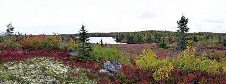
The trail passes through several landscape types — patches of deciduous woodland dominated by red maple or oak, large black spruce stands, mixed red spruce and deciduous forest, fens, and open granite barrens. The barrens support extensive populations of broom crowberry (Corema conradii), a coastal plain species threatened outside Nova Scotia and declining within it, and the rare mountain sandwort. A limited survey of lichens on loops 1 and 2 alone turned up more than 100 species.
The route runs generally along high ground, which is why the vistas keep opening up. Blueberries and huckleberries fruit in abundance in August and September, and their leaves turn the barrens brilliant red from late September to mid-November. Black bear, moose and coyote all live here. The Five Bridge Lakes Wilderness Area is home to a group of roughly 30 endangered mainland moose.
Why the trail was built
The purpose of the trail is to allow the Woodens River community and the public generally to become aware of the extraordinary natural assets of this area, on the principle that awareness is the first step in protection.
Much of this land is barrens: unsuitable for harvesting wood and, at least until recently, difficult to develop into residential areas. As a result it has been left wild — wild not only in the sense of being undeveloped, but in the sense of not being directly controlled by human needs and interests. The bush is often extremely dense, and hiking here without a trail is difficult.
When people go there, they are immediately impressed with its wildness. The experience is forbidding and alienating for some. For others it creates feelings of awe and even reverence. We believe that once people have experienced this wildness, most will understand its importance to their lives and the lives of their children, and will not let it be destroyed.
The trail dedication
A sign dedicating the trail to wilderness preservation was placed at the junction for the Pot Lake Loop in the summer of 2010. The words were written by Richmond Campbell on completion of the trail in 2005.
On behalf of all the wild things that make this land their home and with reverence for the First People who preserved this land before us, we dedicate The Bluff Wilderness Hiking Trail to wilderness preservation. We do this in trust that we can learn its deep beauty, in trust that we can understand and delight in the wildness in ourselves that we share with the rocks, earth, water, and teeming life and spirits that surround us, and in trust that we will work together to protect this sacred heritage.
Renaming Indian Hill Loop to Mi'kmaw Hill Loop
At a board meeting on 9 February 2016, WRWEO agreed to approach the Mi'kmaw community for direction on renaming the second loop of the trail. The loop was then called Indian Hill, and the directors considered the term derogatory, archaic and offensive.
All four loops had been named more than a decade earlier using settler names for the geography. Rather than continuing that pattern, the chair wrote in July 2016 to Mike Lancaster, Wilderness Steward with the St. Margaret's Bay Stewardship Association, asking to be introduced to members of the Mi'kmaw community who might advise WRWEO on how to ask for guidance.
Mike Lancaster contacted Ellen Hunt, former chair of the Mi'kmaq Burial Ground Research and Restoration Association, and Roger Lewis, Curator of Ethnology at the Nova Scotia Museum of Natural History. Roger Lewis in turn consulted the Mi'kmaq of Sipekne'katik (Shubenacadie) District — K'jipuktuk lies within that traditional territory — and Dr. Bernie Francis, Mi'kmaq linguist and co-author of The Language of This Land, Mi'kma'ki. The consensus was that the name should simply become Mi'kmaw Hill.
WRWEO thanks everyone who took the time to consider the question, with particular thanks to Mike Lancaster, Ellen Hunt, Roger Lewis, Dr. Bernie Francis, and the Mi'kmaq of Sipekne'katik District. Older printed maps still carry the former name; replacing them takes time.